Around Salsomaggiore
Travelling time, amateur: 4 hours and 10 minutes
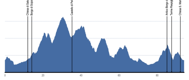
Low-difficulty trail, ideal for those who enjoy climbing. A demanding tour, which takes you nearly 100 km through the area’s surrounding hills, alternating between climbs and descents, some of medium difficulty, with a total of almost 2,000 metres of elevation gain.
With almost 2,000 m of elevation gain over the 100 km journey, this route is suitable for those who love to climb, allowing a panoramic tour of the hills surrounding Salsomaggiore with a succession of ascents and descents that reveal ancient parish churches, castles, and good wine.
Departure from the spa town (the free car park in Viale del Lavoro is recommended); heading towards Fidenza before descending along the Stirone Park and beginning the climb towards Pellegrino Parmense, passing Monte Salso and then descending towards Varano Marchesi to skirt the Ceno stream.
Continuing in the direction of Fidenza, you will pass through Pieve di Cusignano and Siccomonte before beginning the final climb, reaching the village of Tabiano Castello before you return finally to Salsomaggiore Terme.

The route offers not only a beautiful excursion for the avid cyclist but also the adventure of discovering the characteristic hilly landscapes of the “Food Valley”; along the route there are cultivated fields, ancient villas, manor houses, and farmsteads, which produce excellent agri-food products that are renowned throughout the world.
Taking a few stops to break up the route and admire the foothills of the valleys is recommended.
Elevation profile
Places
-
Salsomaggiore Terme
Start 0,0 km
-
Montauro
1,6 km
-
Lodesana
5,1 km
-
Ponteghiara
8,3 km
-
San Nicomede
10,8 km
-
Scipione Ponte
13,1 km
-
Salsomaggiore Terme
15,0 km
-
Cangelasio
16,9 km
-
Valico Pianazzo
21,3 km
-
Grotta
23,1 km
-
Pontegrosso
24,8 km
-
Valico Sant’Antonio
30,05 km
-
Pellegrino
35,3 km
-
Mariano
39,3 km
-
Case Boscaini
40,4 km
-
Varano Marchesi
47,8 km
-
Santa Lucia
50,7 km
-
Case Barbieri
51,8 km
-
Cella
57,1 km
-
Gabbiano
60,5 km
-
Pieve di Cusignano
66,4 km
-
Costamezzana
70,1 km
-
Santa Margherita
76,2 km
-
Osteria del Sole
79,8 km
-
Tabiano
88,3 km
-
Salsomaggiore Terme
Arrival 94,1 km
Length: 94 km
Duration: 4 hours and 10 minutes
Difficulty: Medium
Height difference: 1980 m
Minimum height: 74 m
Maximum height: 650 m
Road surface: Asphalt
Highlights of the itinerary
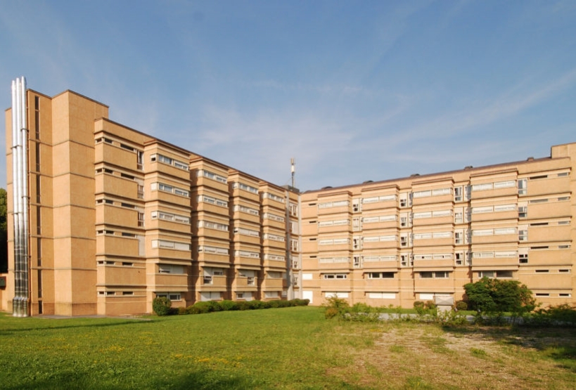
Luigi Zoja Spa
Designed by Franco Albini and Franca Helg, the spa was inaugurated in 1970. Its design, articulated in three arms with a cross-shaped layout, has six floors above ground and is structured around a central core, characterised on the inside by a large helicoidal staircase. The building houses the curative spa centres of Salsomaggiore.

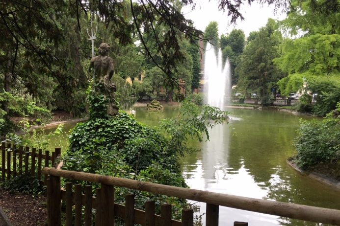
Mazzini Park
The historic public park, which was founded in the early 1900s, is located behind the large modern building of “Terme Zoja”. This green space, which was known in the past as “Parco Regina Margherita” (in homage to Margaret of Savoy, who used to visit the spa), features a typical Italian garden, a pond, and many trees dating back to the first planting of the park.

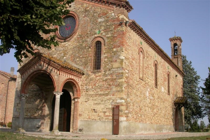
Parish church of San Nicomede
With records tracing it back to the 9th century, this is the oldest church dedicated to Saint Nicomedes in northern Italy and the main centre for spreading the cult of the martyr. The current building, consisting of a single hall supported by trusses and complete with apse and crypt, is the result of the different phases of construction that have taken place throughout its history.

Mountain bike trails
Discover the range of trails
Routes of different difficulty, length, and duration. Here there are also some real mountain bike trails ideal for regional competitions.
Road bike trails
Discover the range of trails
The area around Tabiano Terme offers cycling enthusiasts routes of varying difficulty, length, and duration, ideal for admiring the history, nature, landscapes, and culture of this place.

